


Measure nitrogen on your farm
Nitrogen is free.
Now you can see how much you're getting.
Urea is $1,600/tonne and climbing.
The atmosphere is 78% nitrogen and it costs nothing.
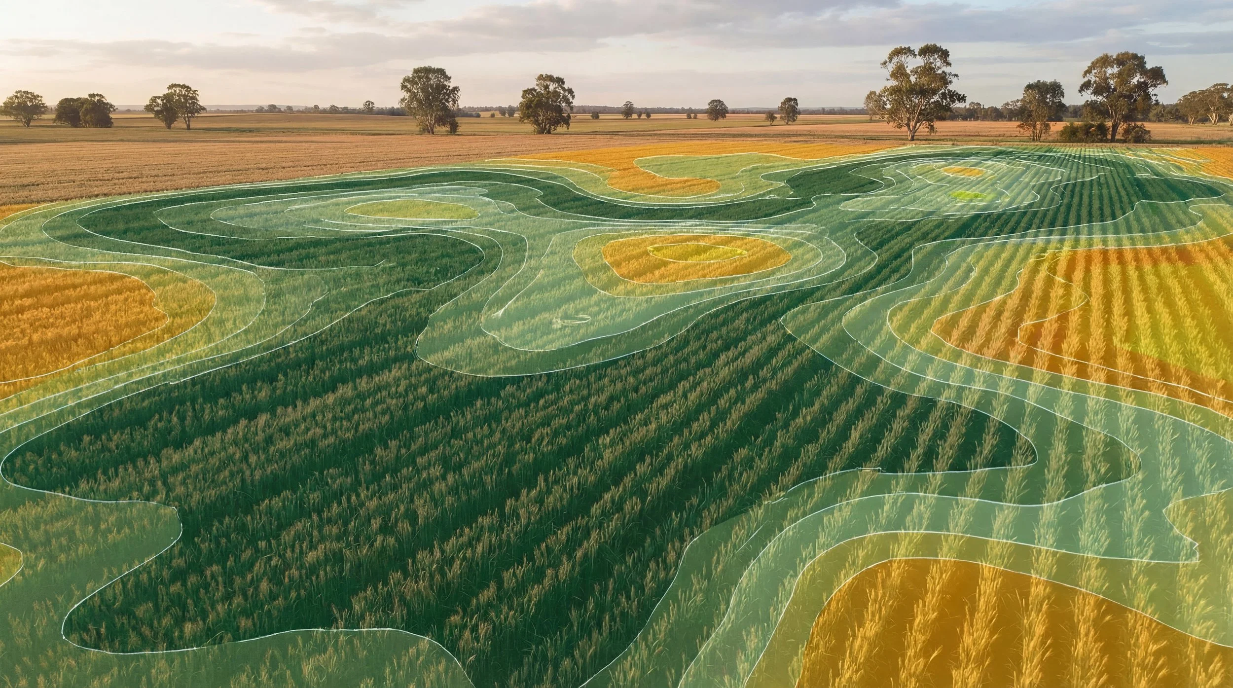
AgriProve has built the world's first high-resolution remote sensing model of soil organic nitrogen - mapping biological nitrogen fixation at paddock resolution, across your whole property, year by year.
We're looking for producers who want to be the first to see what's happening underground on their country.
Register for early access
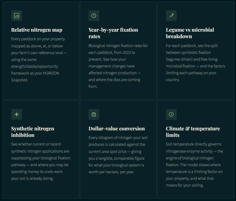
What the model shows
See your nitrogen - paddock by paddock, year by year.
This is not a soil test. It doesn't require you to do anything differently on your property. Using the same satellite imagery that feeds HORIZON, the model generates a real-time picture of what your soil biology is producing - and where it's being held back.
This is a research preview, not a finished product. The process model is sound and the direction of the data is validated. We need more ground-truth data to confirm absolute levels before this is ready to drive farm decisions on its own. That is exactly why we are recruiting early access participants - your property data helps us get there faster. You are helping build something that doesn't exist anywhere else in the world.